Independent consulting · Vancouver, BC

Clearer geoscience data.
Better project decisions.

LongRange Geoscience helps exploration teams organize spatial data, produce clear maps, and move technical work from backlog to decision-ready deliverables.

GISMaps & spatial data
QA/QCOrganized, reviewable outputs
BC · RemoteProject-based support
Consulting services

Focused support for
busy exploration teams.

Start with a defined deliverable or a short discovery call. Scope, schedule, rates, and required professional qualifications are confirmed before work begins.

01 / 03GIS & mapping

Maps that are ready
to use and update.

Clean project structures and repeatable map production for internal review, field planning, presentations, and technical documentation.

  • QGIS project setup  and cleanup
  • Geological maps  plans and sections
  • Spatial data conversion  and projection checks
02 / 03Data organization

Technical data you can
trace and review.

Consolidation of scattered project files into documented, usable datasets with clear assumptions and a practical handoff.

  • Dataset compilation  and standardization
  • Basic QA/QC review  and issue logs
  • Deliverable documentation  for the next user
03 / 03Project support

Extra capacity for a
defined technical sprint.

Short, bounded engagements for teams that need hands-on help preparing field, data, mapping, or technical-work packages.

  • Desktop research  and source tracking
  • Field-data preparation  and closeout
  • Technical figures  and review packages
  • Python scripting  and small internal tools
Selected work

Field context.
Technical clarity.

A small selection of field and technical work spanning reconnaissance, drill-program mapping, and cross-section communication.

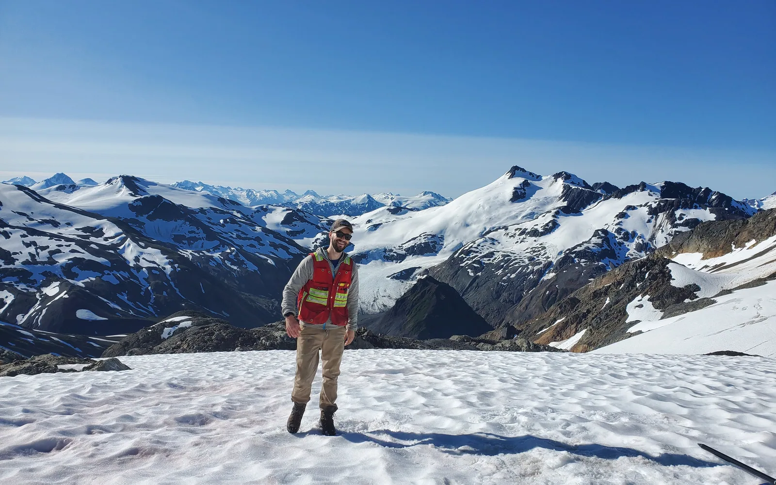
Konrad Chrzastowski conducting field work in mountainous terrain
Field support

Grounded in the project context.

Field experience informs how maps, datasets, and handoffs are structured for the people using them.

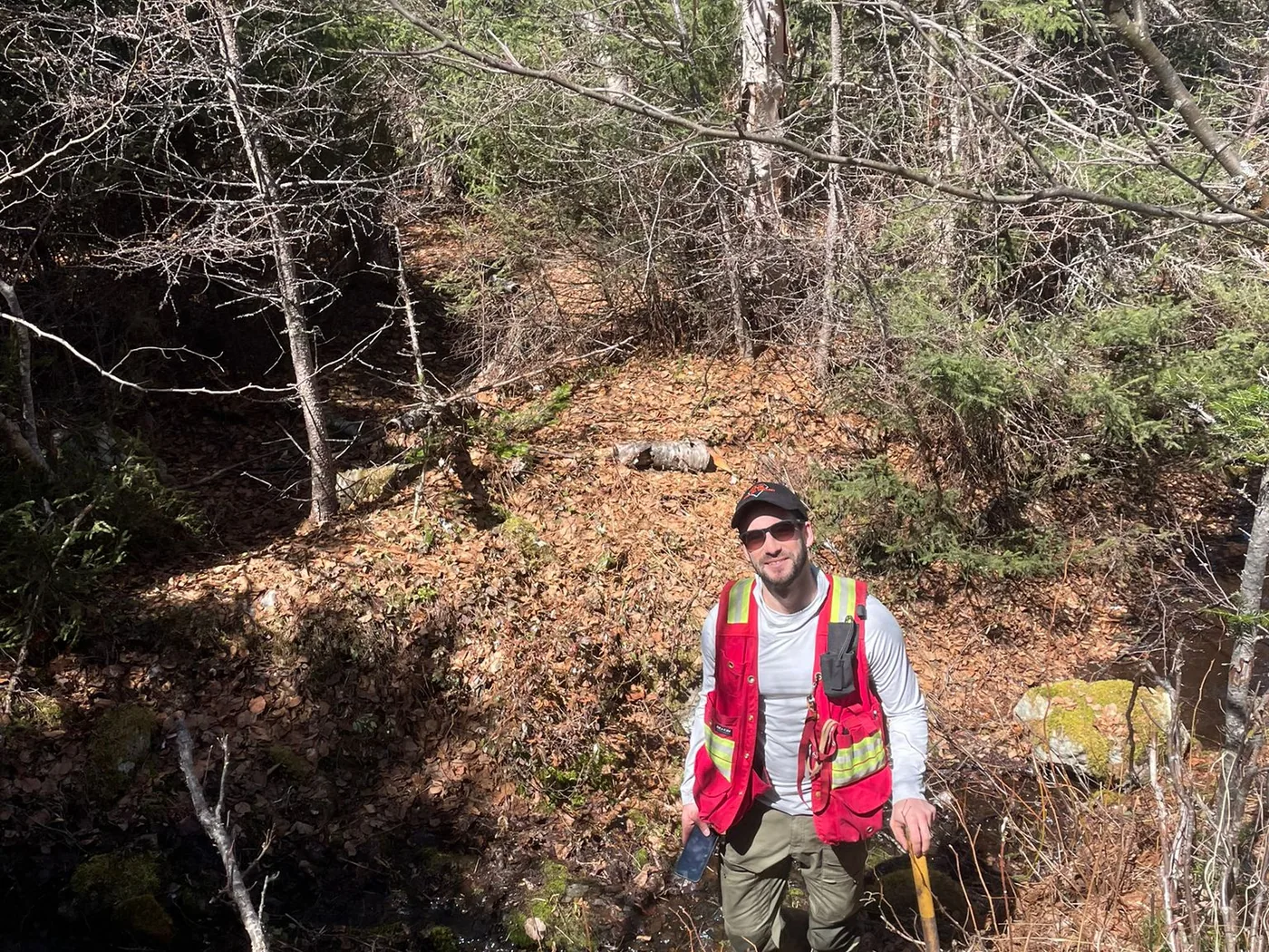
Konrad Chrzastowski completing reconnaissance in forested terrain
Reconnaissance

From observations to usable records.

Practical field support with attention to location, documentation, and clean downstream data.

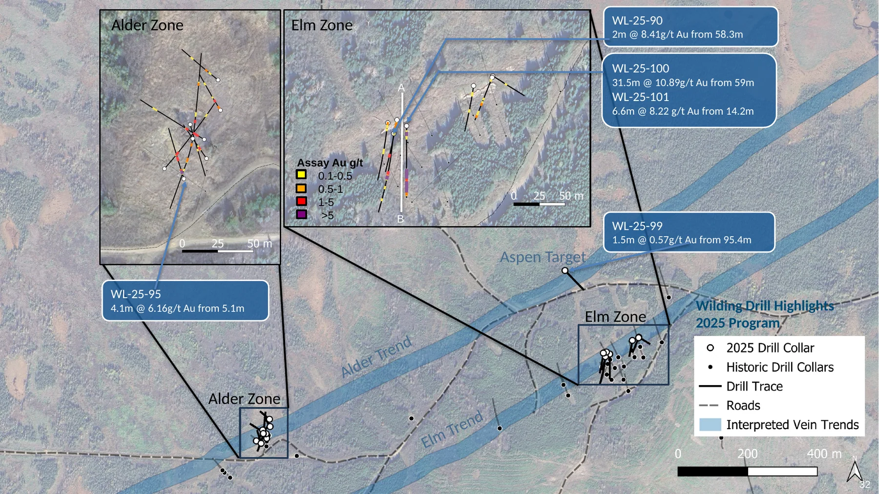
Wilding drill highlights plan map showing drill collars, traces, assay intervals, and interpreted vein trends
GIS & drill communication

Wilding drill highlights

Plan-map synthesis of drill collars, traces, assay intervals, interpreted vein trends, and project access.

Open full figure
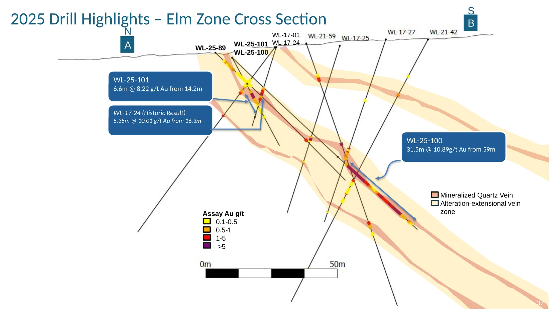
Elm Zone cross section showing drill geometry, assay intervals, mineralized veins, and interpreted alteration
Sections & interpretation

Elm Zone cross section

Cross-section communication combining drill geometry, assay intervals, mineralized veins, and interpreted alteration.

Open full figure

Technical figures prepared while employed by Canterra Minerals Corporation. Project information shown only where publicly released.

Python & applied technology

Automate the repeatable work.
Keep the judgment geological.

LongRange can build project-specific scripts, data pipelines, and small internal apps that reduce repetitive day-to-day work while keeping sources, assumptions, and review steps visible.

Project application02
Targeting support

AI-assisted target screening

A project-specific workflow can bring geological, geochemical, geophysical, and spatial evidence into a consistent screening process—helping teams compare targets and document why each one advanced.

  • Repeatable evidence compilation and first-pass ranking
  • Traceable inputs, criteria, and human review points
  • Outputs designed for geologist review, not black-box decisions
Project application03
Data acquisition

GeoPackage-to-data workflow

Start with a project boundary in a GeoPackage and automate the search for relevant public geoscience layers and web services, then return organized source data with a clear retrieval log.

  • Area-of-interest driven source discovery
  • Consistent naming, projection, metadata, and folder structure
  • Faster project setup without losing source provenance

The useful unit is the workflow, not the buzzword. A small script may be enough; a lightweight internal app can be scoped when repeat use, review, or sharing makes it worthwhile. Automation supports professional judgment and is configured around the project’s data access, source terms, and confidentiality requirements.

Discuss an automation idea
How a trial engagement works

Small scope.
Useful result.

01

Share the problem

Send a short note about the project, current files, desired output, and deadline.

02

Confirm the scope

Receive a written outline of deliverables, assumptions, timing, and fees.

03

Complete the sprint

Work proceeds in a defined block with a midpoint check when the scope needs it.

04

Handoff clearly

Get the agreed files, notes, and a short walkthrough of what changed.

Why LongRange
Konrad Chrzastowski, founder of LongRange Geoscience
Konrad Chrzastowski, P.Geo., M.Sc.Founder · Geoscience consultant

Field experience, technical depth, and practical delivery.

LongRange Geoscience was founded by Konrad Chrzastowski, a Professional Geologist with more than eight years of mineral exploration, project geology, and corporate development experience. His work has covered VMS, orogenic gold, kimberlite, and magmatic systems across British Columbia, Newfoundland and Labrador, and the Northwest Territories.

Konrad's background reaches from helicopter-supported mapping, core logging, and multi-million-dollar exploration programs to geological modelling, drillhole database verification, resource support, technical due diligence, and NI 43-101 disclosure. He has also built practical GIS, PostGIS, and Python workflows—including data pipelines, repeatable analysis, and small internal applications—that make project data easier to review, communicate, and use.

LongRange brings that field-to-decision perspective to focused GIS, mapping, data, and technical communication assignments. Engagements stay deliberately clear: the scope, confidentiality needs, professional requirements, schedule, and fees are agreed before work begins.

8+ yearsExploration & project experience
P.Geo.Registered in BC & NL
M.Sc.Geology · University of Toronto
Field → decisionData, maps & technical communication
A good first engagement should solve one real problem and leave the project easier to work with than it was before.
Start a conversation

What is sitting
in the backlog?

Book a short discovery call, or send a description of the files, outcome, and timing. A useful first conversation will clarify fit and the next step—without a sales presentation.

Discovery call

Choose a time that works.

Appointments are available with at least 24 hours’ notice. Pick an available time and Google Calendar will provide the booking details.

View available times
LocationVancouver, British Columbia · Remote across Canada
Good first projectA defined GIS, mapping, data-cleanup, or technical-figure package
Opens a draft in your email app. Nothing is stored on this site.